

Wettervorhersage für Falls Creek, Skigebiet
Victorian Alps, Australien
Schneevorhersage im Überblick
ac_unit
Nächste 24 Stunden
0 cm.
ac_unit
Nächste 3 Tage
0 cm.
Wetter für 6 Tage. Wetterbedingungen mit Temperaturen, Wolken, Regen, Schneefall, Wind.
Wettervorhersagedetail
| Messgröße | 08 Nov 17:00 | 20:00 | 23:00 | 09 Nov 02:00 | 05:00 | 08:00 | 11:00 | 14:00 | 17:00 | 20:00 | 23:00 | 10 Nov 02:00 | 10 Nov Jetzt05:00 | 08:00 | 11:00 | 14:00 | 17:00 | 20:00 | 23:00 | 11 Nov 02:00 | 05:00 | 08:00 | 11:00 | 14:00 | 17:00 | 20:00 | 23:00 | 12 Nov 02:00 | 05:00 | 08:00 | 11:00 | 14:00 | 17:00 | 20:00 | 23:00 | 13 Nov 02:00 | 05:00 | 08:00 | 11:00 | 14:00 | 17:00 | 20:00 | 23:00 | 14 Nov 02:00 | 05:00 | 08:00 | 11:00 | 14:00 | 17:00 | 20:00 | 23:00 | 15 Nov 02:00 | 05:00 | 08:00 | 11:00 | 14:00 | 17:00 | 20:00 |
|---|---|---|---|---|---|---|---|---|---|---|---|---|---|---|---|---|---|---|---|---|---|---|---|---|---|---|---|---|---|---|---|---|---|---|---|---|---|---|---|---|---|---|---|---|---|---|---|---|---|---|---|---|---|---|---|---|---|---|
| - | - | - | - | - | - | - | - | - | - | - | - | - | - | - | - | - | 0.1 | - | - | 0.1 | - | - | - | - | - | - | - | - | - | - | - | - | - | - | - | - | - | - | - | - | - | - | 0.1 | 0.1 | 0.1 | - | - | - | - | - | - | - | - | 0.4 | 0.7 | - | - | |
| terrainISO-0m | 2400 | 2400 | 1600 | 1500 | 2200 | 2500 | 2900 | 2800 | 3300 | 2900 | 3200 | 3000 | 3100 | 3100 | 3000 | 3000 | 3100 | 3200 | 3300 | 3300 | 3300 | 3300 | 3300 | 3400 | 3500 | 3700 | 3800 | 3800 | 3800 | 3900 | 3800 | 3800 | 3700 | 3900 | 4000 | 4000 | 4000 | 4100 | 3900 | 3900 | 3900 | 3900 | 3800 | 3700 | 3500 | 3500 | 3300 | 3400 | 3500 | 3600 | 3500 | 3500 | 3400 | 3300 | 3400 | 3400 | 3500 | 3600 |
BERG 1780 m ac_unit Neuschneecm | - | - | - | - | - | - | - | - | - | - | - | - | - | - | - | - | - | - | - | - | - | - | - | - | - | - | - | - | - | - | - | - | - | - | - | - | - | - | - | - | - | - | - | - | - | - | - | - | - | - | - | - | - | - | - | - | - | - |
| Temperatur°C | 4 | 1 | 0 | 0 | 1 | 1 | 6 | 8 | 9 | 7 | 7 | 7 | 7 | 7 | 9 | 11 | 12 | 11 | 12 | 12 | 12 | 11 | 14 | 15 | 13 | 11 | 10 | 10 | 10 | 12 | 14 | 16 | 16 | 14 | 15 | 14 | 13 | 12 | 14 | 16 | 16 | 16 | 14 | 14 | 11 | 12 | 11 | 12 | 15 | 13 | 10 | 10 | 9 | 8 | 8 | 11 | 10 | 8 |
| cloud_queueWetterlage |  |  | |  | | | | | | | | | |  | | | |  | |  | | | | | | | | | | | | | | | | | | | | | | | | | | | | | | | | | | |  | | | |
| near_meWindkm/h | 25  | 25  | 23 | 19 | 13 | 10 | 4  | 6  | 10 | 3  | 9 | 13 | 13  | 15 | 18 | 19 | 19 | 22 | 18  | 22 | 20 | 8 | 11 | 6  | 12 | 16 | 13 | 6 | 1  | 5 | 13 | 13 | 11 | 3 | 9  | 20 | 18 | 15 | 20 | 23 | 19 | 16 | 22 | 22 | 21 | 21 | 28 | 27 | 18 | 1 | 1  | 3 | 1 | 3 | 2  | 6 | 8 | 14 |
TAL 1500 m ac_unit Neuschneecm | - | - | - | - | - | - | - | - | - | - | - | - | - | - | - | - | - | - | - | - | - | - | - | - | - | - | - | - | - | - | - | - | - | - | - | - | - | - | - | - | - | - | - | - | - | - | - | - | - | - | - | - | - | - | - | - | - | - |
| Temperatur°C | 6 | 2 | 0 | 0 | 1 | 2 | 7 | 11 | 11 | 9 | 8 | 8 | 8 | 8 | 11 | 14 | 15 | 13 | 14 | 15 | 14 | 14 | 16 | 17 | 16 | 12 | 11 | 12 | 12 | 13 | 16 | 19 | 19 | 16 | 17 | 16 | 14 | 14 | 17 | 19 | 19 | 19 | 16 | 16 | 13 | 14 | 13 | 14 | 17 | 15 | 12 | 11 | 10 | 9 | 9 | 13 | 11 | 9 |
| cloud_queueWetterlage | | | | | | | | | | | | | | | | | | | | | | | | | | | | | | | | | | | | | | | | | | | | | | | | | | | | | | | | | | |
| near_meWindkm/h | 24 | 22 | 20 | 18 | 12 | 9 | 1 | 5 | 6 | 2 | 7 | 10 | 9 | 11 | 14 | 18 | 19 | 19 | 9 | 17 | 18 | 5 | 10 | 7 | 17 | 19 | 16 | 10 | 3  | 3 | 12 | 14 | 11 | 1 | 3 | 16 | 14 | 12  | 17 | 23 | 18 | 12 | 22 | 14 | 15 | 15 | 20 | 20 | 16 | 9 | 10 | 7  | 7 | 9 | 7 | 3 | 16 | 22 |
Quelle der Vorhersage
WERBUNG
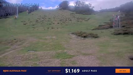
Diese Schneevorhersage für Falls Creek, Australien gibt den vorhergesagten Schneefall und die Gefrierwerte für die nächsten 4 Tage an. Es sind Pisten befinden sich auf einer Basishöhe von 1500 mts und der Gipfel befindet sich auf 1780 mts über dem Meeresspiegel in Victorian Alps-Bergen.